STUDIES OF CONDITIONS AND DIRECTIONS OF SPATIAL DEVELOPMENT OF MUNICIPALITIES
Study of the conditions and directions of spatial development for the city of Pruszków
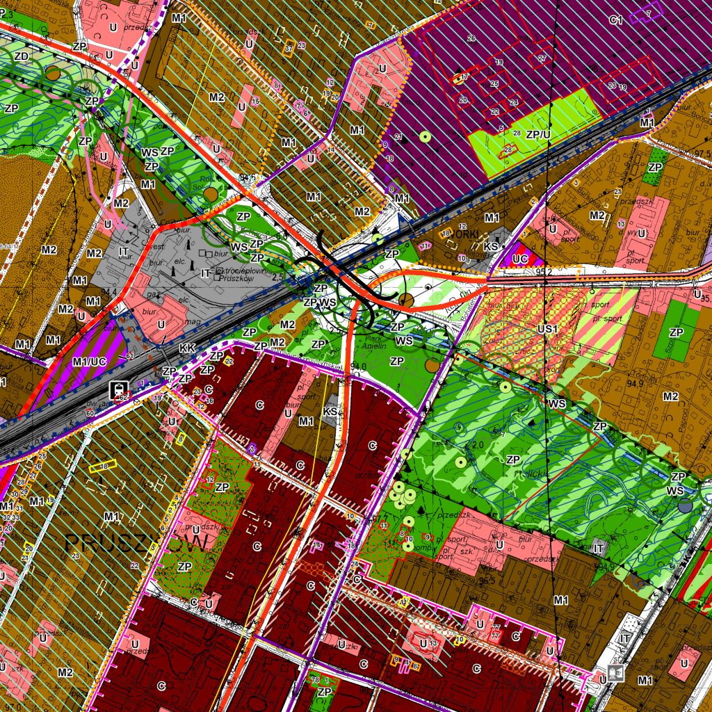
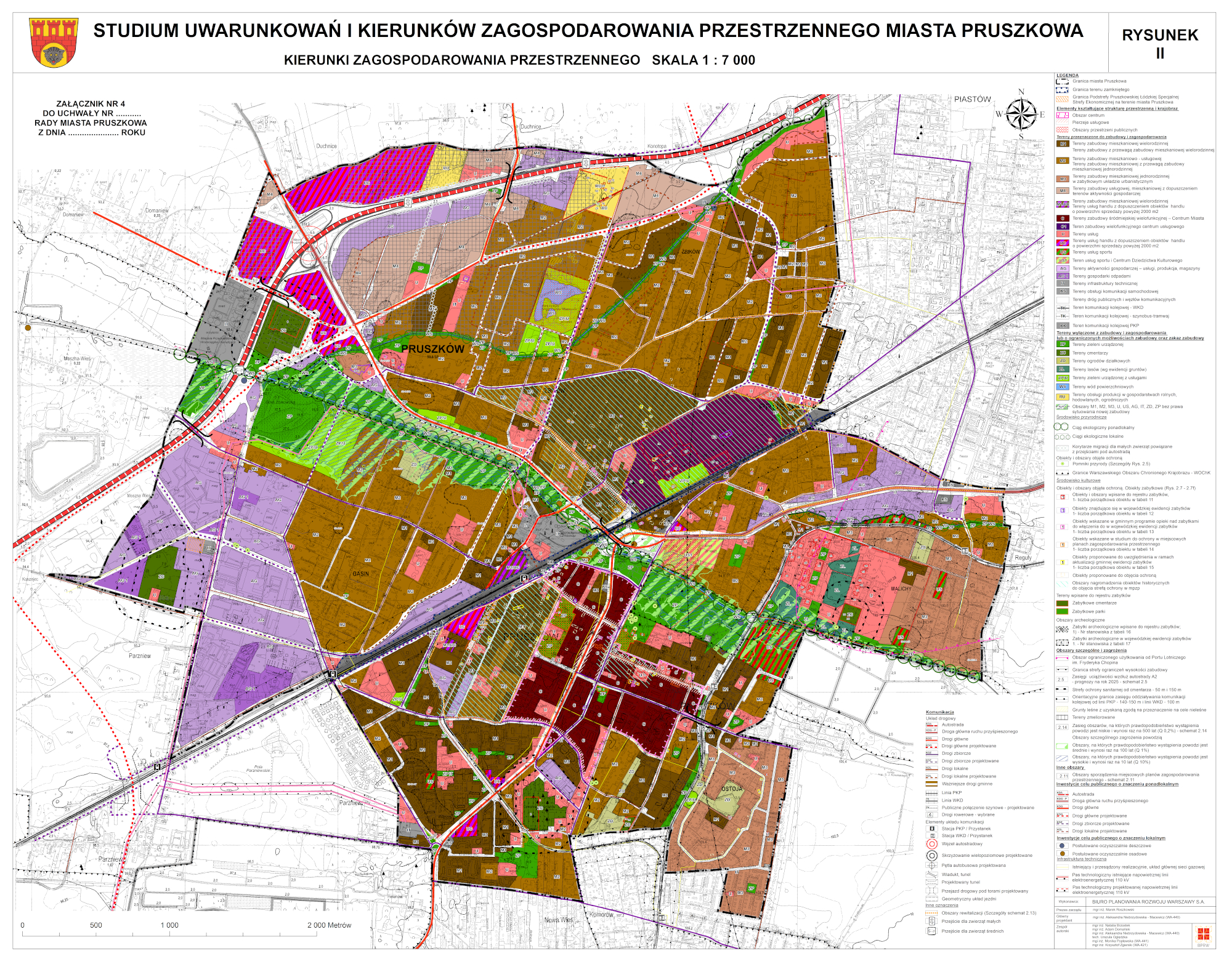
The Study of the conditions and directions of spatial development for the city of Pruszków covers the whole area of the borough within its administrative boundaries – 1,919 ha. The location in the western part of the Warsaw Metropolitan Area makes Pruszków a city with a great development potential. There are strong ties between Pruszków and Warsaw in economic, infrastructural and social terms. Currently, the city functions mainly as a housing and industrial and service center. Transport links, such as the A2 motorway and the planned Paszkowianka, as well as the Brwinów – Skierniewice – Warsaw railway and the WKD [Warsaw Commuter Railway] lines are beneficial for development. The functional and spatial structure specified in the Study is supposed to enable the achievement of the assumed goals. Within the urbanization areas, the leading functions and directions of development were determined, assuming the dominant function of multi-family and single-family housing, with necessary services for residents. Non-urbanized areas of high natural values were designated as protected against the new investments. One of the goals of improving the quality of life of residents is shaping the public spaces. In the central part, there is a railway line which divides the city into north and south. In the southern part, the areas of multi-functional downtown buildings – the city center – were marked out. The areas of economic activity are concentrated mostly in the western part of the city and to a lesser extent in the north and east – in all cases close to the city limits.