URBAN AREA PLAN
Local spatial development plan for Chrzanów
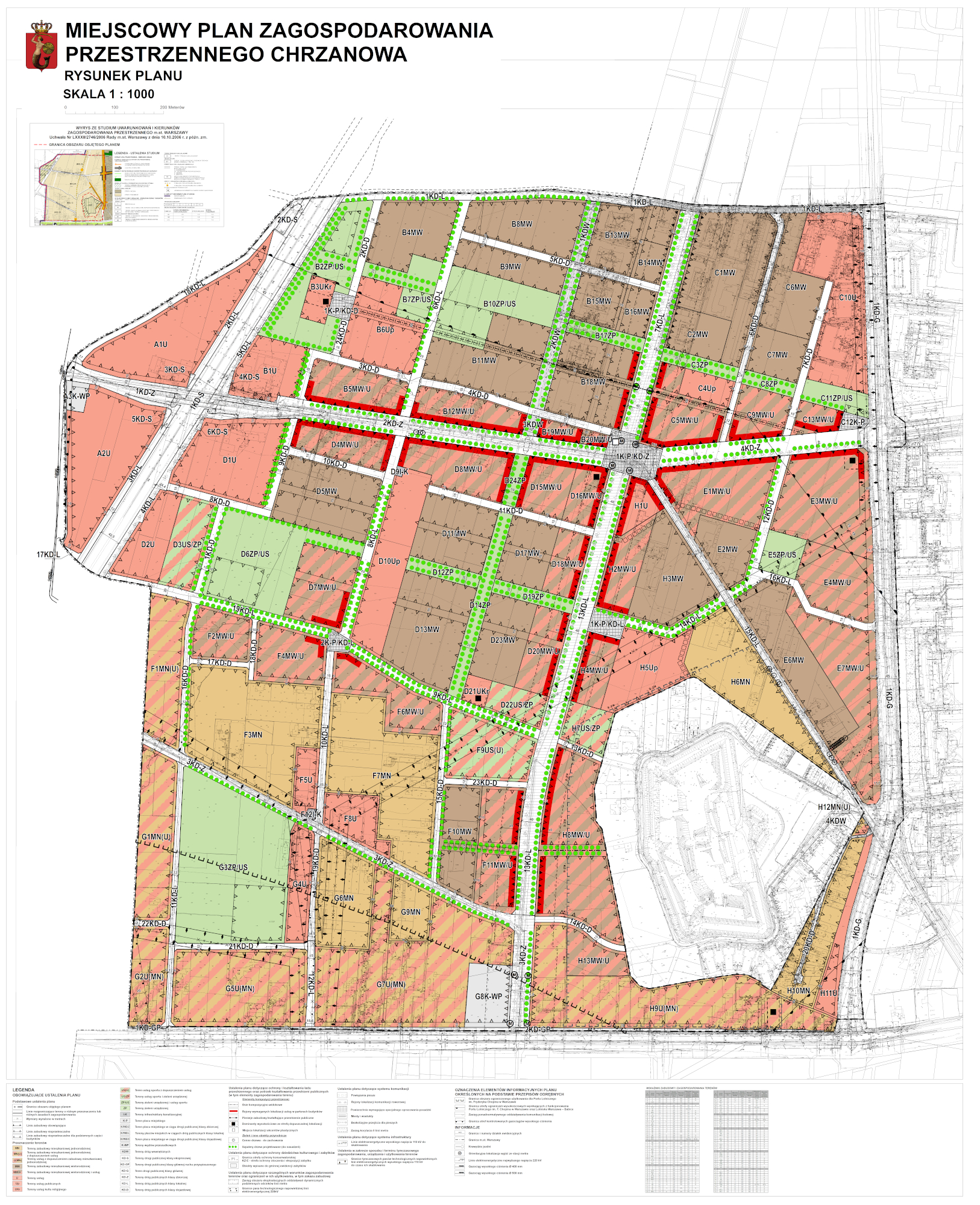
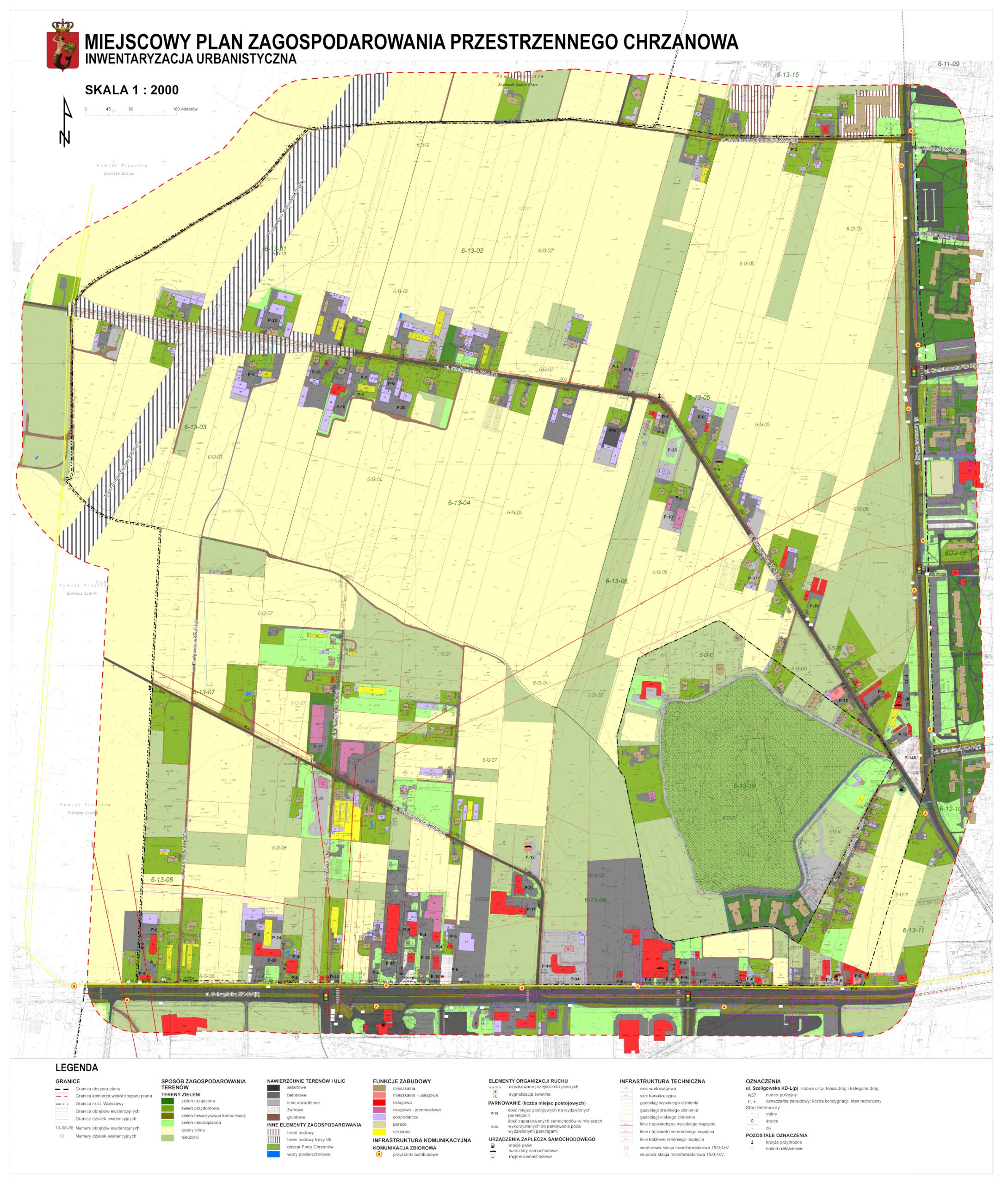
The Local spatial development plan for Chrzanów covers the area in the western part of Bemowo District, delimited by Połczyńska Street (from the south), Batalionów Chłopskich Street (from the north), Lazurowa street (from the east) and the S8 expressway (from the west). Due to a number of favorable conditions, including transport accessibility (Warsaw-West Junction), recreational areas (Fort IV “Chrzanów”) and a well-developed social infrastructure, a functional and comfortable space for residential development has been created in this area. The local plan outlines a new, internal communication system, multi-family and single-family housing development areas, service development areas and areas serving as public spaces (arranged greenery zones, squares). According to the plan, this region is gradually being transformed into a resident-friendly place.