STUDIES OF CONDITIONS AND DIRECTIONS OF SPATIAL DEVELOPMENT OF MUNICIPALITIES
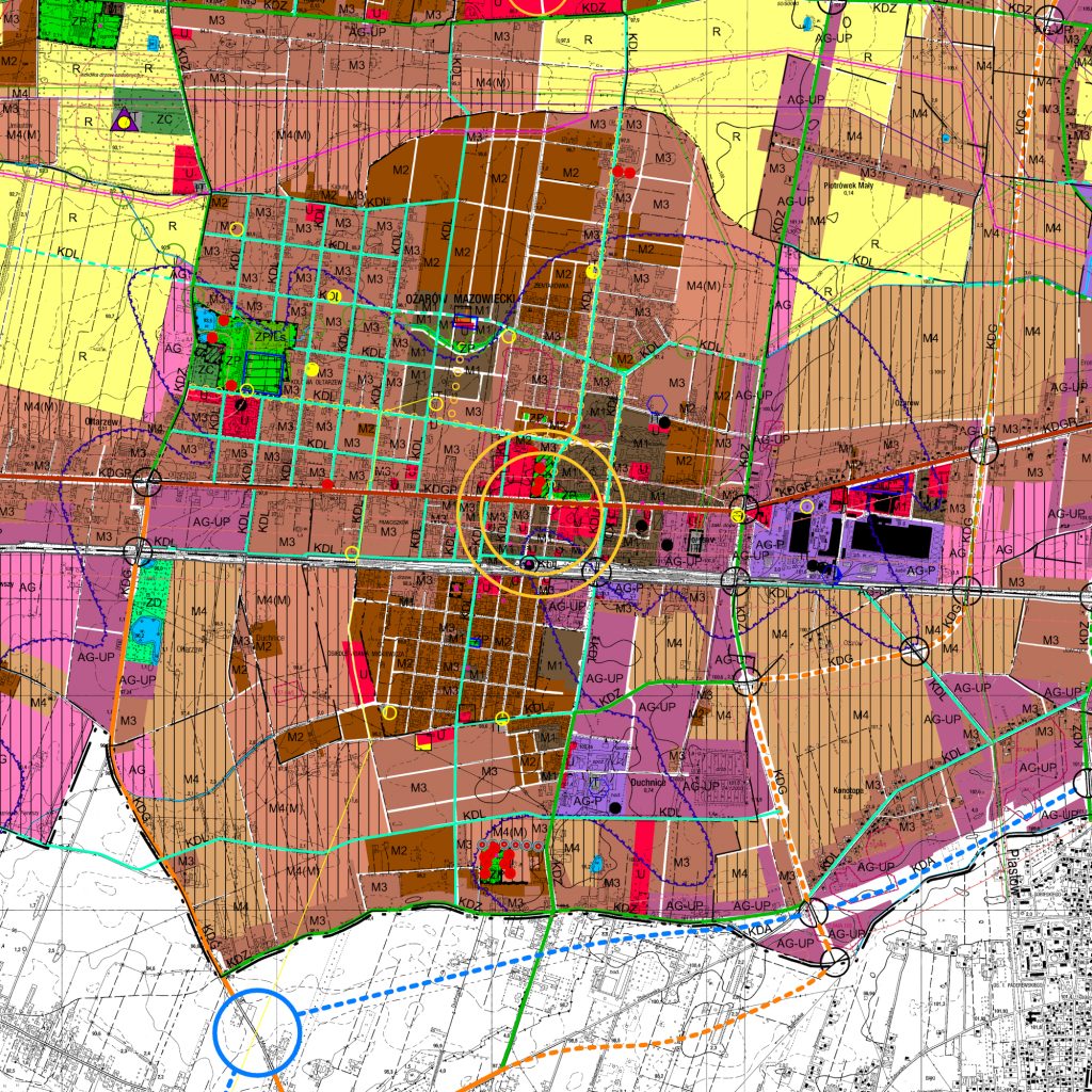
Study of the conditions and directions of spatial development for Ożarów Mazowiecki Borough
The Study of the conditions and directions of spatial development for the city and borough of Ożarów Mazowiecki covers the whole area of the borough within its administrative boundaries – 7,130 ha. This rural and urban borough is located in the Masovian Voivodeship, Warsaw West County, in the immediate vicinity of the capital city of Warsaw. Ożarów Mazowiecki is adjacent to the following boroughs: Leszno and Babice Stare, Warsaw, Piastów, Pruszków, Brwinów and Błonie. Two primary factors which influence the functional and spatial structure of the Ożarów Mazowiecki city and borough are the location in the Błońska Plain, which is agricultural production area with very good soils and a high degree of agricultural development, and the close proximity of Warsaw. The strategic location of the borough, in the most important vegetable growing region in Poland, as well as its advanced infrastructure determined the modern functional profile of the borough, which can be described as industrial and agricultural. The short distance from the center of Warsaw has resulted in a dynamic development of the residential function, especially in recent years. The road network of the Ożarów Mazowiecki Borough enables national, regional and local connections. Railways (long-distance E-20 line and suburban) play a secondary role in the public transport system. The greatest intensity of road traffic occurs on the national road No. 2 from Poznań to Warsaw, which is not sufficiently adapted to perform collision-free transit functions. On the other hand, the planned roads and the railway line constitute limitations in the development of land for residential or service purposes. The functional and spatial structure of the borough area, as defined in the Study, makes it possible to enhance its appeal and the offer for residents and tourists. In order to define clear rules for the development, the borough was divided into two functional and spatial zones: “urbanization zone” and “non-urbanized zone”.

