PLANS FOR SUBURBAN AND RURAL AREAS
Local spatial development plan in the area of Sążnista Street
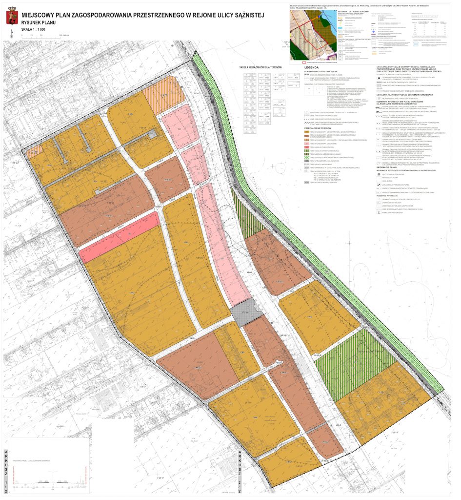
The Local spatial development plan for the Sążnista Street area covers the region located in the north-eastern part of the Wilanów District in Warsaw, in the vicinity of the Vistula river valley – on its western bank. The area of the plan is not within the immediate reach of the streets forming the main road network of the city. Its connection with Przyczółkowa Street (fast traffic trunk road, located to the west of the study boundaries) ensures a system of collective and local roads. A fragment of the planned Czerniakowska-Bis Street – ultimately the main road – was located within the boundaries of the study. Approximately 300 m south of the study boundaries, an expressway is being designed, which will constitute a part of the Warsaw Southern Bypass – the Southern Bridge Route. According to the draft plan, this will be mainly a single-family housing development area. The share of residential and service areas as well as service and transport areas will be smaller. All service development in the area of the plan are to be unobtrusive services. The design of the plan takes into account the location within the flood risk range.
