PLANS FOR SUBURBAN AND RURAL AREAS
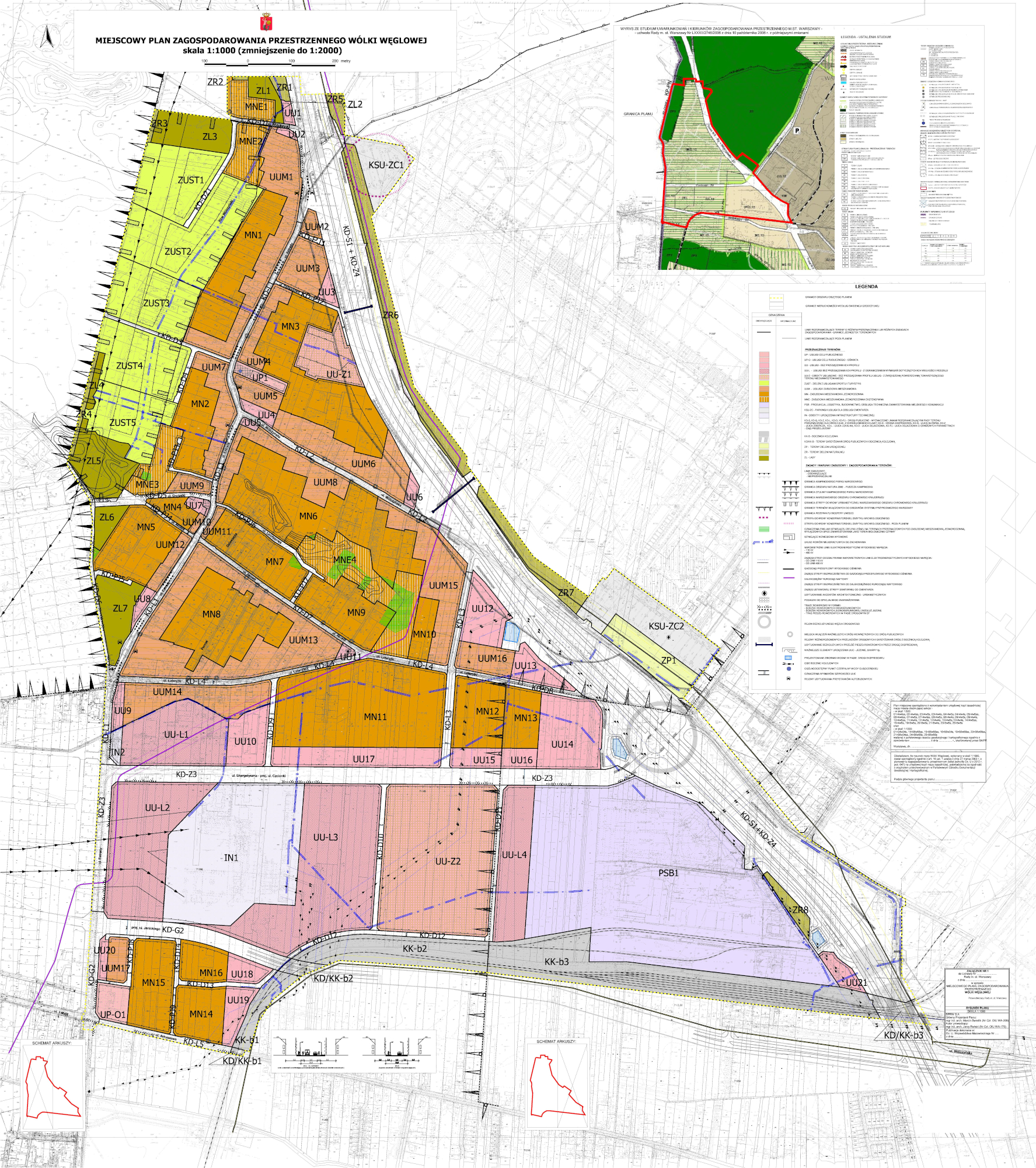
Local spatial development plan for Wólka Węglowa
The Local spatial development plan for Wólka Węglowa covers an area located in the western part of the Bielany District in Warsaw, situated between the Kampinos National Park and the Northern Municipal Cemetery, additionally limited from the south by a railway siding. The southern part of the plan area, in the vicinity of the railway siding, covers various types of services, production, logistics, construction, technical services for municipal investments and communication areas. On the other hand, the northern part of the plan includes residential and service development areas of various forms. The plan sanctions the existing development of these areas, introducing at the same time the zoning of functions, by designating areas with varying degrees of approval for the implementation of services. In the north-western part of the area, bordering the Kampinos forest complex, green areas with sports and tourism services were designated.